
Talk about a more exciting and more challenging Easter egg hunt - or a variation of it!
Wouldn't it be a rip-snorting exercise to engage some people's geographical and navigation skills so they can find a cache or two? We're talking about one GPS application - a recreational one - that has quite a large following of Internet fans.
Geo-caching is only one of the leisurely applications of the global positioning system which can be added to the list of GPS uses. And the list keeps getting longer.
With the GPS capabilities for air, land, and sea navigation, inventive GPS techno-buffs are churning out ways to turn GPS fans into obsessive treasure hunters.
. . . .
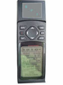
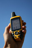
Geo-caching involves a hand-held GPS device that owners can use to travel to a specific longitude and latitude to find objects (treasures) deliberately hidden there by geo-cachers.
Don't start thinking of geo-caching in terms of the California gold rush. Given its recreational nature, these cache objects are truly valueless - they may contain inexpensive trinkets, two-dollar bills, coins, memento or "antique" jewelry that doesn't work. Sorry, folks, no economic opportunities to be harnessed here. It's all for the sake of sheer, wholesome fun. As one poet so very well articulated, it isn't the destination that counts, it's the journey!
That is the geo-caching principle. People go into the Internet and get these treasures' coordinates and set out to find them. Then they go back to their computers and relate their experiences. One variation of geo-caching is actually not to lay claim to the object, but to leave something else or move it to another location, so that there is "fodder" for the next hunter.
That's the light side of GPS. Moving now into a more serious discussion, these applications can be classified into four or five categories:
-Military
-General aviation and commercial aircraft
-General navigation
-Precision-time reference
-Visually impaired individuals
With respect to the military application, this was the original intention of the $12 billion investment of the United States government. The military objectives relating to cruise missiles and smart bombs were at the core of GPS technology (if you want to sound even smarter than a smart bomb, you can say "precision-guided munitions" to impress your listeners). Military strategists also rely on it for monitoring the U.S. Nuclear Detonation Detection System.
Precision-time reference applications refer to the use of a GPS reference clock for time-sensitive generators or network time protocol (NTP) clock. An example would be the seismologic endeavors of both the public and private sectors. GPS can also be used for the synchronization of clocks in computer systems.
As for general navigation applications, GPS is used by people here and abroad as an aid in cars, airplanes, and ships.
The application for visually impaired individuals is an interesting field of study because people have recognized the capabilities of GPS to help the blind. Collective efforts to devise tools for the visually impaired are continuing, and GPS technology will fuel those efforts further.
One little detail that we want to mention is "tracking logs." Hypothetically, if we had a compulsive and obsessive adventurer who likes to wander off to remote islands, thickly wooded forests and unheard of safari jungles in places whose names you can't even pronounce, that adventurer would never have to panic if he felt disoriented or lost. Before setting out into uncharted territories, he simply has to activate his GPS tracking log capability, and it will record every detail of a turn, a detour, or a reverse motion. This information is stored in his GPS computer, and if he wants to take the same route on the return voyage, the data will be there for him.
Read More...
Sabtu, 28 Maret 2009
GPS Applications Explained
What A GPS Can Do For You

A Global Positioning System or GPS is one of the most fun technical gadgets available on the market today. They are now available to anyone who has the means to buy them. Some may ask why they would need a GPS. The fact is, your GPS can help you in more ways that you realize and it's quite amazing what this device can actually do for you.
. . . .
Have you ever been driving around, knowing your in the right vicinity, but you can not, no matter how hard you try, find the street address of where you needed to be five minutes ago? Or taken a wrong turn somewhere and not know how to get back to where you started from? This little gadget can change all that for you and make your driving days easier. From satellites, the GPS can hone in on your location and tell you exactly where you are and how to get to a certain location. This is especially great for anyone who works out of their vehicle, such as a salesman or real estate agent.
There are many things a sportsman could use the GPS for, as well. Not only finding the location of the deer he thinks he may have shot, but also to find his favorite fishing hole he has trouble locating each year. A hunter or fisherman will never have to worry about getting lost in the woods or on the water again, as long as they carry a GPS with them.
A GPS is also wonderful for a landscape photographer. The GPS will be able to help them to return to a scene in case that first shot didn't come out the best. The GPS will also allow them to work in a timely and efficient manner, by planning out their trek each day in advance. Keeping track of their mileage is also an added benefit.
The health enthusiast may use the GPS to trek their daily route and check how far they have walked or run, as well as how fast. Not only will it keep track of all this for them, they will not have to worry about excising too much or too little by guessing how far they've gone. This works great for the cyclist, as well. The GPS will help them not only to keep track of where they are going, but how far they have left to get to the top of a steep hill and if they have a guidebook or map with them, the GPS will let them know exactly where they are on the route and let them know if the map is correct.
The GPS is a great tool for anyone, including the teacher who is working to teach their class geography, maps, and navigation. There are several ways the GPS can be used in the class room. Set up a treasure hunt to find items listed only by the digital location or play hide-and-seek, only having the location of the hidden known by the student with the GPS. The GPS will not only teach a child about maps and navigation, but it will allow them to learn while having fun.
Of course, while most of these uses are from the average person, the fact is that GPS has become a very necessary part of our lives. The system is used by many to not only save lives, but to safeguard others, as well. The GPS in your vehicle or cell phone can help someone to find you if you're missing. Ambulance crews and fire departments use the GPS to make sure they get to the location of an emergency. Construction crews use the GPS to navigate equipment, even if visibility is low and the military uses for the GPS are endless. The GPS has added a way for everyone, the average person to the military fighter pilot to navigate the world in which they live in.
Read More...
Five Uses For GPS Systems

Perhaps you haven't bought a Global Positioning System (GPS) yet because you don't feel you need it. You can't see going to the expense of buying one when you can get directions the old fashioned way - from other people or from a map.
Many people are under the impression that the only benefit a GPS has for the average person is that it is a more convenient way to get driving directions. And while it is a very convenient way to map navigation, there is far more that the average person can do with a GPS than just use it for mapping.
Here are a few uses for a GPS that may get you thinking about purchasing one.
1.) A GPS can help you locate a lost child. There are several GPS devices on the market that are designed to be used for this purpose. Some look like watches that lock on a child's wrist. Others look similar to cell phones. . . . Some are even equipped with panic buttons that allow the user to press a button during times of distress, signaling that he needs help. The signals from these devices are often transmitted to a central location that will then call you on a predetermined phone with the location of your child. Of course, these devices can be used for other people besides children.
2.) A GPS can help you locate a lost pet. A tracking device is placed on your pet's collar or in a special backpack that can be fitted to your pet. When your pet goes missing you can retrieve the information about its whereabouts through the type of transmitter that you have chosen. Two popular methods of retrieving the information are through a cell phone and the Internet. There are also software programs available that will alert you if your pet has gone out of boundaries that you have predetermined.
3.) When working in conjunction with your cell phone, a GPS can allow you to call for assistance from anywhere, and your location can be tracked. This means that if you get into a car accident in a location that is difficult to identify, emergency vehicles can easily find where you are. Or, if you are hiking in the woods and become injured, help can track you down.
4.) You can use your GPS as an exercise monitor. If you walk, run or cycle regularly and like to change your route frequently, a GPS is a great tool to use. It can let you know how fast you are moving. It can also tell you how much distance you have covered. You can easily ensure that you get the exact number of miles in that you want, even when you are taking an unfamiliar route.
5.) A GPS device can help you create a high tech scavenger hunt. A GPS scavenger hunt is much like a traditional scavenger hunt. Teams of people have to hunt down clues which lead them to their final destinations, often collecting items along the way. However, the teams use GPS handheld receivers to get from clue to clue as opposed to traditionally written directions.
These are just a few of the things that the average person can use a GPS device for. There are hundreds of other uses for a GPS that don't involve driving directions.
Read More...
Rabu, 25 Maret 2009
What Are GPS Devices

Device Works By Triangularization
The purpose of these satellites was to be able to allow the US military to determine its exact position through a system of triangularization (actually called trilateration). A hand-held, or vehicle mounted device, would receive signals from at least three satellites. The GPS unit would then process that information to inform the user exactly where they were located. By receiving signals from at least four satellites, the device could give not only the latitude and longitude, but also the altitude.
Satellite System Completed
The GPS system of having 24 satellites in position was accomplished in 1994. Each of the satellites, weighing more than 3,000 pounds each, and designed to last for ten years, orbits the earth twice a day at an altitude of about 12,000 miles. Years before this system was completed, the military permitted civilians to begin using it.
Deliberately Inaccurate Signals
When civilians began to use the system, the GPS satellites deliberately transmitted a degraded signal. This deliberately inaccurate signal was designed to prevent an enemy from using our own signals against us, and it was called Selective Availability (SA). While using the SA, the signals generated a rather generally accurate location to within about 100 meters. This system of generalized readings was turned off by the military in May 2000.
Current Accuracy of GPS Devices
Today, however, the GPS system works very accurately - but it does depend on where you are in relation to the satellites. If they are either more or less lined up, or bunched together, then the reading won't be all that accurate. Other factors can cause an increased inaccuracy such as being near tall buildings, dense foliage, atmospheric disturbances, etc. On the other hand, since satellites are continually moving (about 7,000 mph), if you allow the GPS device to get a couple of readings from the satellites, then your position will be more accurately determined. The accuracy today, depending on how new your device is, and the features it has, could be accurate to with a 5 to 10 meters. The enhanced features of some particular brands can bring this down to within 3 meters, while the military devices can put them within a millimeter, or two.
Satellites Transmit Three Pieces of Information
Your device receives three different pieces of information from each satellite that it picks up communication from - a pseudorandom code, ephemeris data and almanac data. This data deals with the number of the satellite, the position of the satellite, and the status of it, which concerns whether or not it is working properly. This last one includes the transmission of the time that the signal was sent, and then your GPS device measures how long it took to receive it. By this means, then, along with signals from other satellites, it will calculate your position.
Parents Using GPS To Keep Tabs On Teens

GPS technology is useful for pinpointing an exact location of a person, or residence for example. Having this information readily available is essential in emergency situations. 911 centers use Global positioning systems to direct police/fire/rescue personnel to those in need of emergency assistance. Most planes today are also equipped with GPS systems that will emit a signal that can be used to locate a plane that has lost radio-contact with air traffic controller's or that has crashed in a remote area. GPS not only produces radio-frequency signals that can be used for tracking, they can also provide detailed maps and directions to guide someone from one place to another. Such technology is especially helpful for traveler's who can access real-time maps, including important exits, city streets, etc.
Parents of teenagers have found that the "tracking" capabilities of the Global Positioning System, or GPS is a valuable 'tool' for them to use in order to keep tabs on the activities of their teens. GPS technology can track and record the movements of a vehicle that has GPS equipment installed, and also through cell phones and hand-held devices that are carried by teenagers. Children are involved in so many extra-curricular activities these days. They have soccer, football, and basketball practices, club meetings, and rehearsals for the school play to name just a few. Keeping up with a child's schedule, all the while hiving to meet work and other family obligations is a full-time job in itself.
And when teenagers get their driver's licenses and become mobile, they are even harder to keep up with. Teenager's are constantly on the move, they are: hanging out at the mall with friends, at the skating rink, taking in a movie, grabbing some fries at the drive- thru, "cruising" and so on. GPS can be installed in vehicles to track its movements, and can also be found in cell phones, hand-held devices, and computers. This allows parents to keep tabs on their ever-increasingly, mobile teens. Parents can view exactly where there teenager is through hand-held receivers or even with a home computer via the internet. Parents can then be assured that their adolescents are where they are supposed to be.
Parents shouldn't think that by using the technology of GPS to "track" the activities of their teens as an invasion of privacy. It is a parent's responsibility to do all that they can do to safeguard their child, and this is just one more tool to aid parents in keeping their kids safe. Let's face it: there is a lot out there for teens to deal with: peer pressure, alcohol, drugs, sex, gangs, and violence. Sometimes just knowing that a parent is keeping track of their whereabouts can help a young person to make the right choice for themselves.
Teens too, shouldn't feel like this GPS technology is just another way for their parents to be "over-protective' and not trusting of them. GPS technology can be a lifesaver in many ways for the teen on the go. If your car should get stolen, the police can use the GPS installed in your car to track and recover your vehicle, and maybe even apprehend the offender(S). Driving can be dangerous for anyone, flat tires, accidents, and mechanical issues can arise any time that you're out on the road. GPS technology provides added security for the teenager who is out and about. If the car breaks down, or has a flat, a GPS device can be used to contact someone for help. GPS is critically important should the car break down in an "unfamiliar" or "unsafe" area because GPS will pinpoint the exact location of the disabled vehicle so that teens don't have to become stranded in these situations. With the valuable tool of GPS technology onboard, parents and teen's can be assured that assistance will be sent where, and when it is.
GPS In The Public Interest
The applications for GPS units run from simple personal use to complex wartime data. These devices may seem intimidating, but they are opening a whole new world that is being explored in many new and awesome ways. The good news is this portable technology is routinely used to save lives, time and money.. . . .
Imagine a woman has been critically injured in a remote location a dozen miles from the nearest town. Park Rangers find her, but they're going to need some help. They call for an air ambulance; however they bypass the need to give detailed instructions on how to find them. Instead, they simply provide GPS coordinates and the helicopter arrives in time to save the life of the injured woman.
A bus operator takes a nasty spill and will not be able to drive for awhile. This might present a problem if someone else does not know the route. However, route training time could be eliminated in public transit with the use of GPS technology. Policies could be adopted that would map each route using a GPS. While the bus driver would be missed, the route would not suffer a delay in service.
We've all had moments when we sat with a stubborn vehicle on the side of the road. If you own a GPS unit it can be used to pinpoint your location for a tow truck.
Imagine a time when missed directions in critical situations become a thing of the past. Many police and ambulance personnel are now dispatched using GPS technology. Lives may be saved, hostile incidents curtailed and even pizza may have a better on time delivery record.
Firefighters are now using GPS units to help guide helicopters providing support to multiple water drop points. By using these small handheld devices, fire crews can maximize the effectiveness of fire control efforts that can save both lives and personal property.
Wilderness excursions can be less problematic when a GPS unit is linked to compatible walkie talkies. This technology will allow people to keep in contact and help them find each other if you get separated.
Should rescue workers be required to find a location in the dark it is good to know that GPS units have no problem pinpointing a location - even on a moonless night.
Outdoor enthusiasts use GPS units to assist them in keeping track of how far they have gone and can help track a route to either avoid or try again.
Admittedly, sophisticated GPS devices have been used by governments during wartime and peace, but savvy consumers have found many ways to utilize this technology to help provide peace of mind in uncertain circumstances.
More uses for GPS technology will be discovered in the days to come and the implementation of that technology will assist the public in ways they may never realize. Then again, when something is this good, bragging isn't required.
GPS How It All Started

That was the amount spent by the American government for its global position system or GPS for short. Satellites are expensive, but when you seriously think about what a GPS can accomplish, it may well be worth every single cent.
The United States Department of Defense no doubt had the proper rationale for inventing the GPS. In fact, in light of recent events that have developed as a result of 9/11, military and defense strategists are probably heaping praise on the DOD for its GPS efforts. GPS has turned out to be a very useful tool in their strategies to protect the country and its allies from potential disaster.. . . .
They also have Ivan Getting to thank.
GPS: how it started
Funny how Ivan Getting's name almost fits in with the primary function of GPS - "getting location." GPS is a tracking tool, if you will, and for it to remain in optimal working order, a budget of $400 million a year is required to monitor the satellites so they don't fall out of orbit, so to speak. The budget is also allocated to replace aging satellites.
Ivan Getting was born in New York City in 1912. He enrolled in the Massachusetts Institute Technology with an Edison scholarship and received his Bachelor of Science degree in 1933. After MIT, he went on to pursue his Master's Degree as a Rhodes Scholar at Oxford University.
Dr. Getting obtained his Doctorate in Astrophysics in 1935 - a rare accomplishment in those days.
Less than 20 years later, Dr. Getting joined Raytheon Corporation as Vice President for Engineering and Research. When the Air Force announced a need for a guidance system to be used in conjunction with an ICBM that would achieve mobility by traveling for railroad use, Raytheon came up with a three-dimensional, time-difference-of-arrival position-finding system, the first of its kind at the time. It is a technique that represented one of the most sophisticated technologies in the world, since the concepts that were integrated into its design served as the stepping stones for the development of the global position system - GPS.
Dr. Getting directed aerospace engineers and scientists to evaluate satellite use - the core for a navigational system for rapidly-moving vehicles based on three dimensions. This eventually led to the concept utilized for the design of GPS.
In 1993, the military declared that GPS was now a fully operational world utility - an essential component for modern navigation on land, water and air. Its use extended to map making and land surveying. Today's uses for GPS, however, go beyond these preliminary applications.
As to be expected with technologies of this magnitude, GPS underwent major improvement in the year 2000, when the Wide-Area Augmentation System (WAAS) was employed to increase the accuracy of signals emanating from GPS. This accuracy is made possible by one of many techniques known as the differential GPS, or DGPS.
When the United States Department of Defense developed the system, it was called NAVSTAR GPS - the acronym for Navigation Signal Timing and Ranging Global Positioning System.
But it wasn't just Ivan Getting
Let's give credit where it's due. Ivan Getting's impressive role in the establishment of GPS - now a public good - cannot be denied. However, for several decades, people have been trying to figure out the means to pinpoint their exact location on earth. People no longer follow stars to find their way as they did in biblical times; these days, satellites can do that much more effectively.

GPS has come a long way. From the original designers of the think tank group within the United States Navy, GPS has now "arrived" with its 24 satellites.
Remember the Sputnik program back in the 1960's?
When Sputnik was launched, the United States Navy had actually run two programs that were said to be GPS's predecessors. Transit was the name given to the first functional satellite-based navigation system, developed by Richard Kirschner in 1964. Those programs had seven satellites, and it relied on radio signals.
In 1967, the second satellite navigation system, Timation was born. It was an improvement over Transit; one innovation was an atomic clock integrated into its design.
In 1973, the US Navy and US Air Force eventually combined efforts to form the Navigation Technology Program, which became Navigation System and Ranging or NAVSTAR. The first four satellites were launched five years after that joint effort.
Based on its history, therefore, the raison-d'?tre of GPS was purely military in nature. Today, its uses encompass certain activities engaged in by the private sector. It must be mentioned, however, that for reasons of national security, the system used by the public is not as accurate as the one used by the military.